To establish a credible calibration field is the first step to promote calibration system for aerial photogrammetric camera. Starting from 2009, the NLSC successfully established the calibration field for aerial photogrammetric camera at the Nankang Industrial Park, Nantou County in 2014. It contains an inner field with the size of 750X600 m for cameras flying lower altitude to be used for larger scale map production, and an outer one with the size of 2000X1750 m for higher altitude and smaller scale map missions. The NLSC has built fixed-type marks for geometric calibration in this field totally 183 marks, and 2 sets of mobile marks for spatial resolution and radiation calibration. This field has been verified in 2016 by the Taiwan Accreditation Foundation (TAF) its effectiveness of the calibration procedures which accords with ISO 17025.
Maintenance of geometric calibration marks distributed averagely
in photogrammetry camera calibration field
Real-time precise point positioning service
Due to the development of GNSS positioning technology, commercial PPP (Precise Point Positioning) services are currently provided internationally. Although the service can span the world, it takes a long time for users to obtain fixed results. NLSC plans study SSR(State Space Representation) technology, integrate domestic CORS and deploy PPP-RTK(Precise Point Positioning-Real Time Kinematic) service in Taiwan, to provide instant and accurate positioning services for Smart Agriculture, Autonomous Driving, offshore construction, etc.
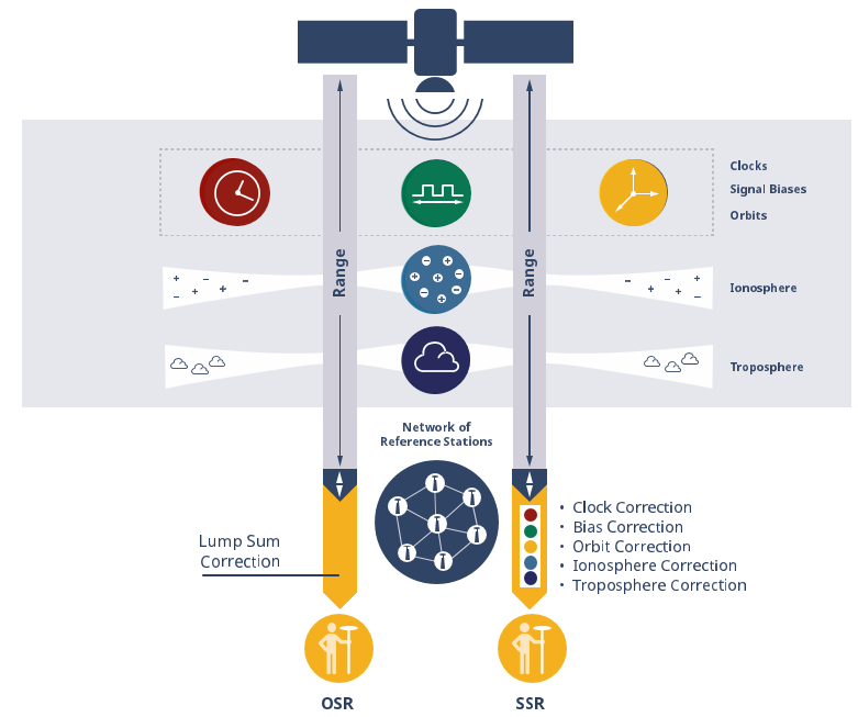
The difference between OSR and SSR technology
CORS data processing and applications
Taiwan is situated in a region of intense plate collision, resulting in significant displacements in some areas. These displacements can compromise the accuracy required for surveying and mapping operations. The NLSC intends to manage the integration and analysis of domestic CORS with the ITRF. It aims to establish an accurate function relationship between them to secure the connection between Taiwan's local coordinate system and other international frames. Additionally, the NLSC will consider the effects of post-earthquake deformation to enhance the precision of the deformation model.
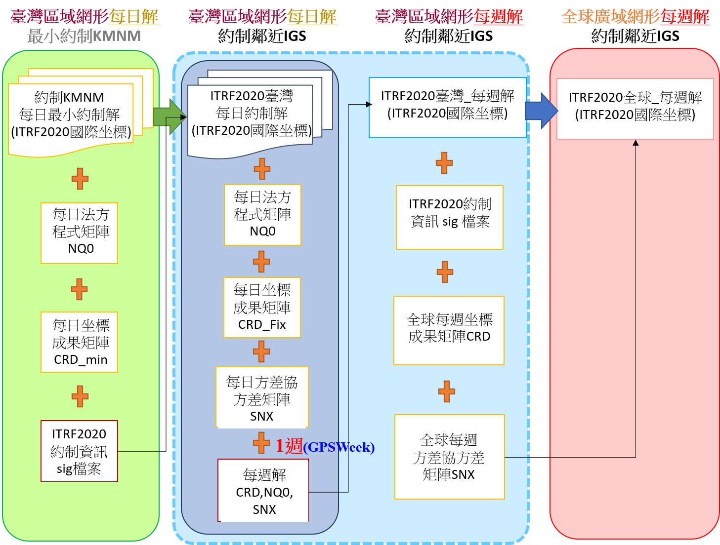
The dataflow chart of the CORS computation