Digital Terrain Model (DTM) is the basis of major national constructions, such as the remote sensing satellite image rectification, the decision-making and management of water resources, the application of hydrological modeling, the flood mode analysis of flood overflow areas, engineering design and planning, and flight safety management. Accurate and detailed digital terrain data are required for these purposes.
From 2004 to 2006, the Ministry of the Interior (MOI) completed the high-precision and high-resolution (5-meter resolution) DTM production work for Taiwan. In order to continue the results of the "High-precision and high-resolution digital terrain model implementation plan", the MOI developed an extension plan which is scheduled to run from 2006 to 2009. The tasks of this plan are as follows:
- Establish rules and develop mechanisms for the maintenance, updating, and management of DTM data.
- Develop high-precision orthorectification techniques and systems.
- Develop airborne LIDAR surveying and mapping technology.
- Introduce and develop Bathymetric LiDAR surveying and mapping technology.
- Develop ground-based 3D laser scanning technology.
- Establish photogrammetry and remote sensing landmarks, natural and artificial feature points database.
- Develop 3D City Modeling Technologies.
Due to variations in surveying methods, data formats, and quality standards, MOI has integrated DTM data from various agencies and established specifications for agencies to follow, facilitating the integration and application of future results.
In 2009, Typhoon Morakot caused severe damage to infrastructure, property and human lives in southern Taiwan. As a result, from 2010 to 2015, the Geological Survey and Mining Management Agency of the Ministry of Economic Affairs in Taiwan conducted an airborne LiDAR survey to produce 1-meter resolution DTM and aerial ortho-photos. These data were used to build a post-disaster high-resolution DTM database and apply it to investigations and analyses of geologically sensitive areas, geological and topographical characteristics, potential geological hazards, and river system analysis.
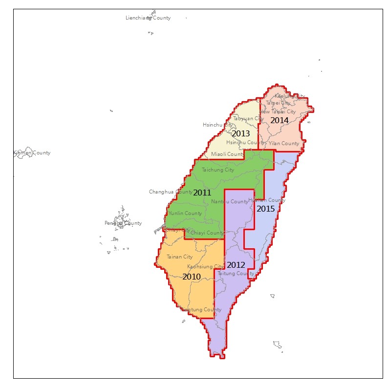
Geological Survey and Mining Management Agency’s annual management scope
In order to continuously update the DTM data, the MOI plans to adopt sub-annual updates using LiDAR technology, drawing on the experience of the Geological Survey and Mining Management Agency. Since 2019, the MOI has entrusted this task to the National Land Surveying and Mapping Center (NLSC), and the second round of updates has now been completed across Taiwan from 2016 to 2024.
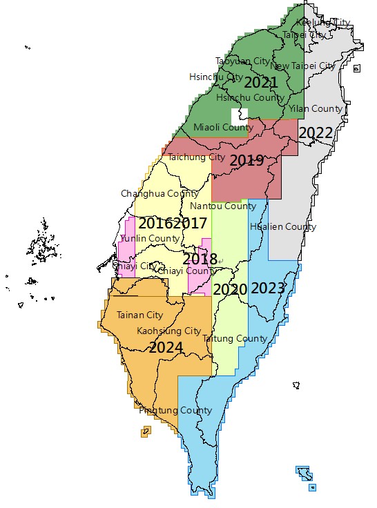
DTM updating areas from 2016 to 2024